Concepts related to Metadata and Catalogs
The following concepts are important to better understand Catalog services:
Resource
Metadata
Search
Catalog
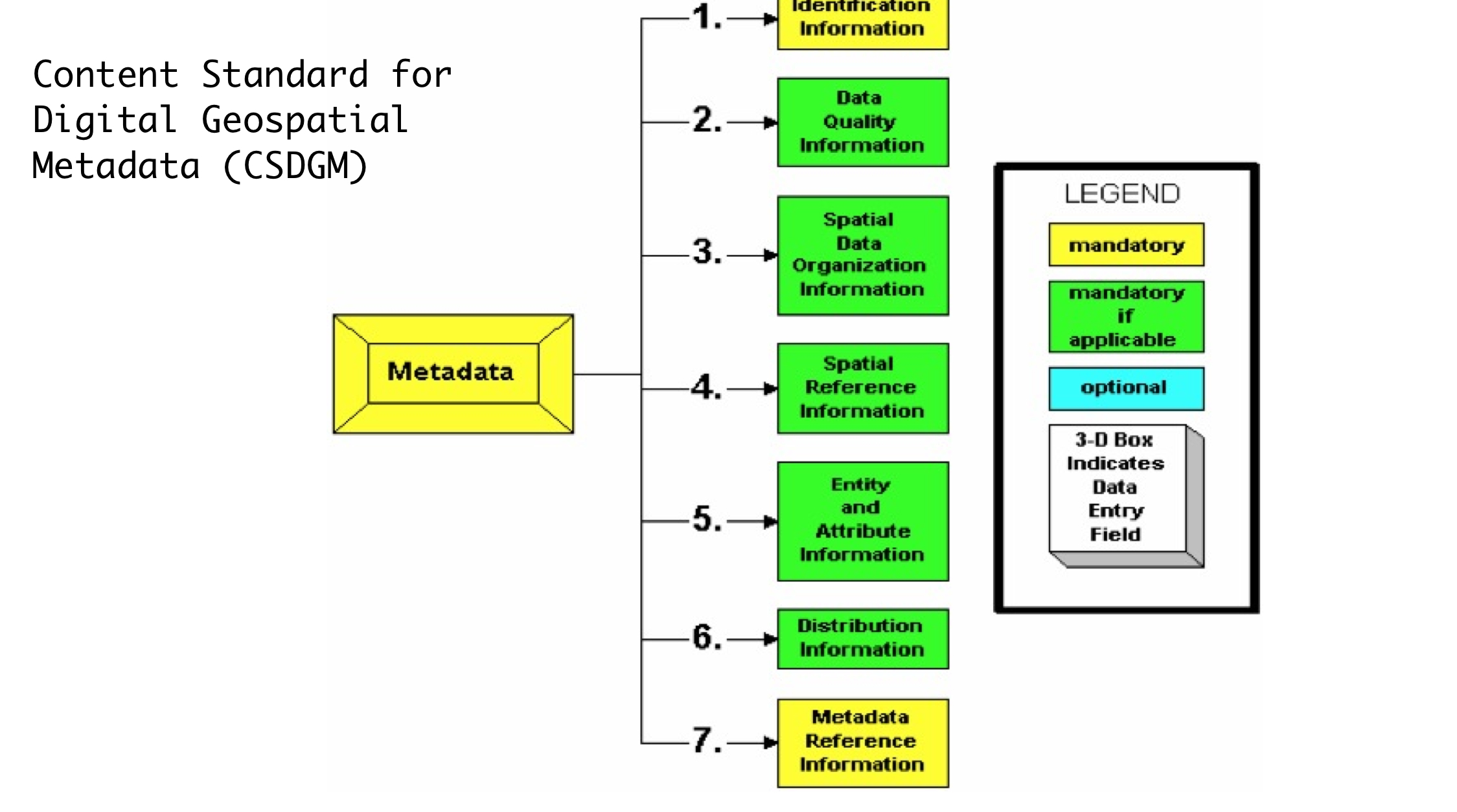
FGDC
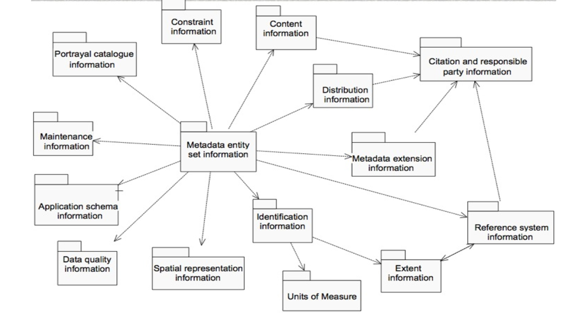
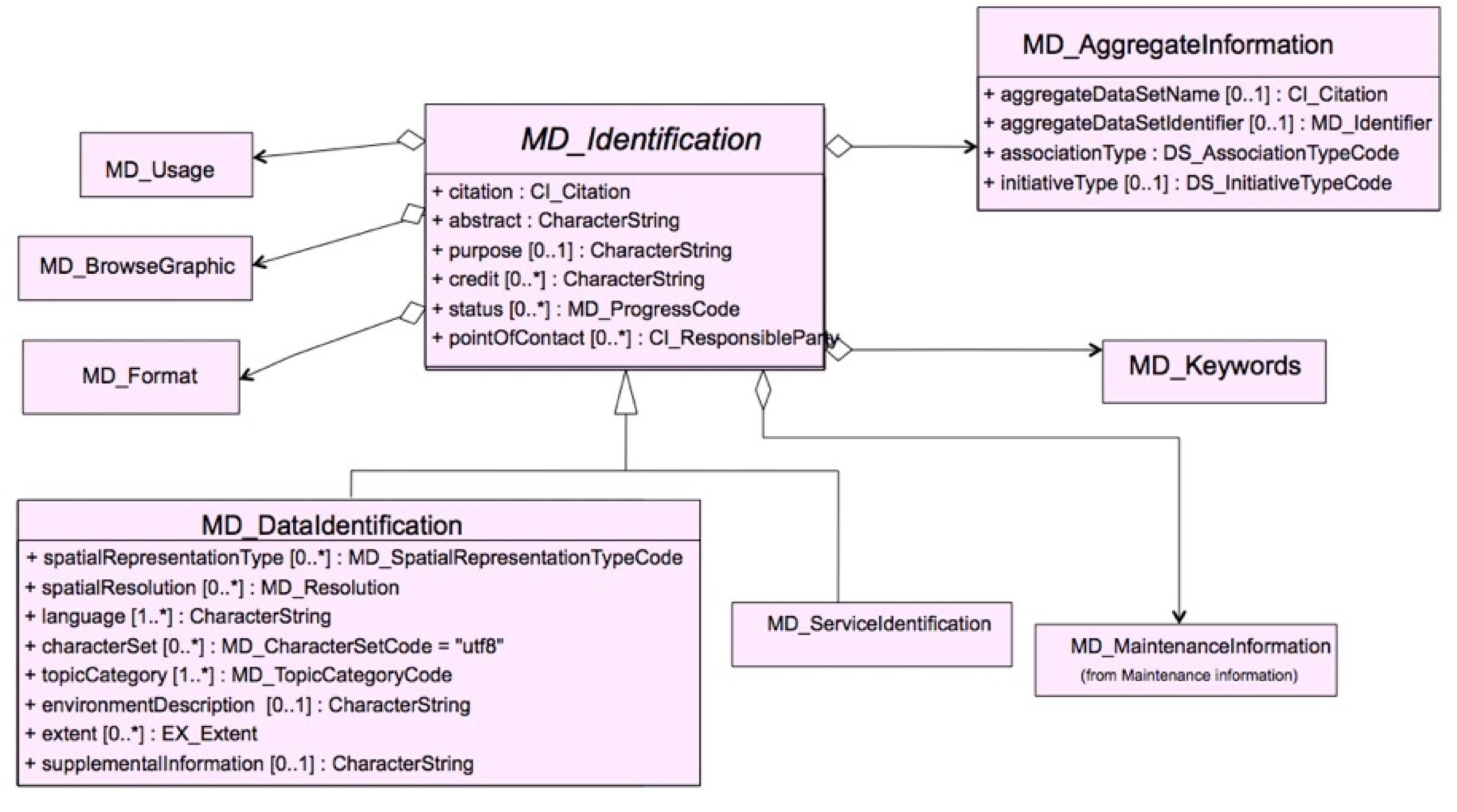
ISO
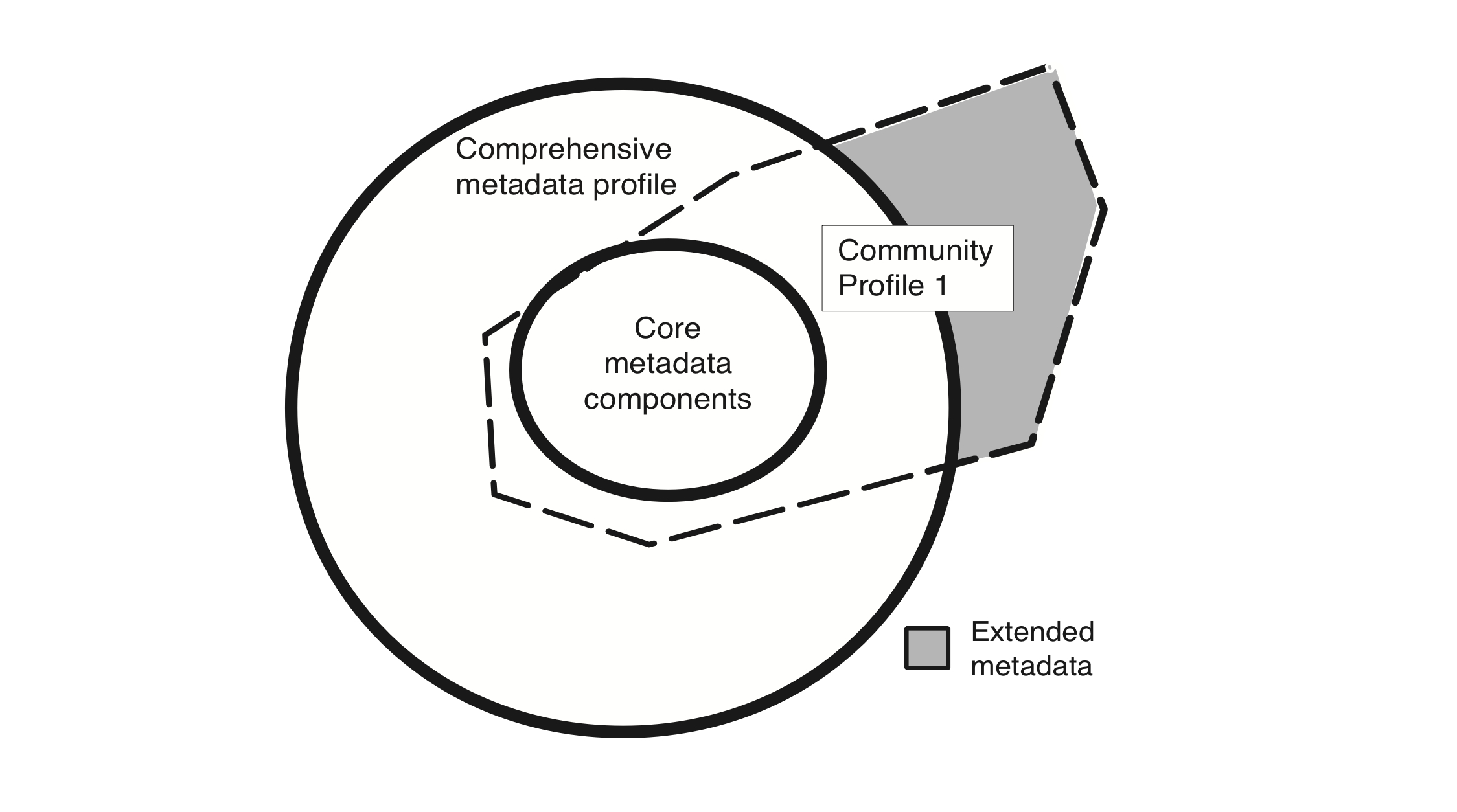
Profiles
CSW Operations
OpenSearch
Metadata Concepts
Resource
A thing
Anything which is worth uniquely identifying (over the Web)
Can be data
Metadata
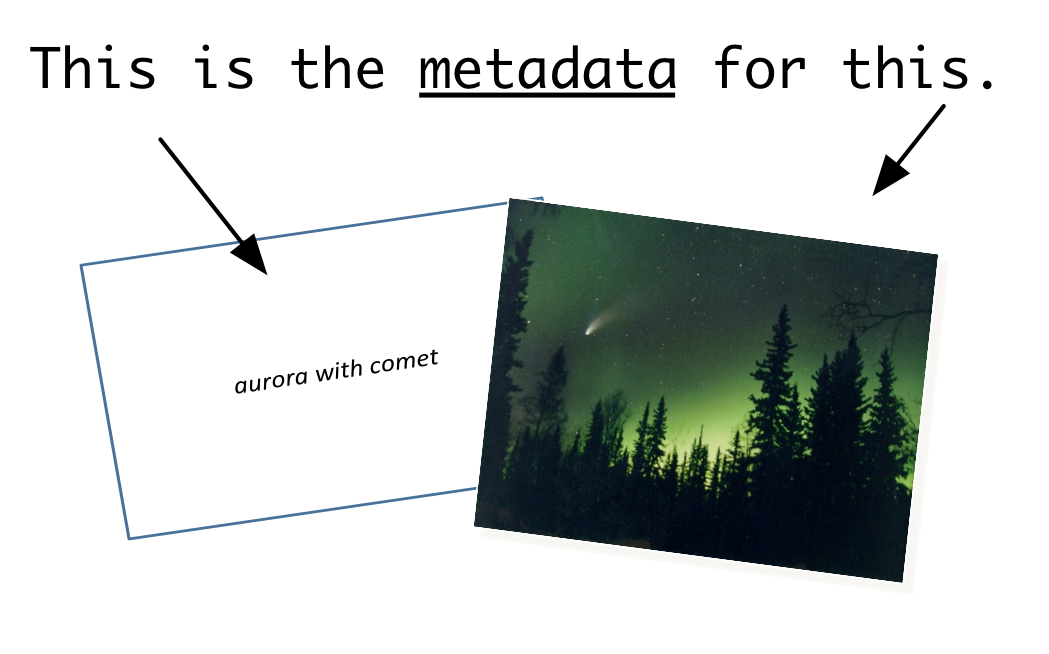
Data about a resource
Data about data
Metadata
What is Missing ?
What is Missing ?
Metadata - Who
Who collected the data?
Who processed the data?
Who wrote the metadata?
Who to contact for questions?
Who to contact to order?
Who owns the data?
Metadata - What
What are the data about?
What project were they collected under?
What are the constraints on their use?
What is the quality?
What are appropriate uses?
What parameters were measured?
What format are the data in?
Metadata - Why
Why were the data collected?
Where
Where were the data collected?
Where were the data processed?
Where are the data located?
When
When were the data collected?
When were the data processed?
How
How were the data collected?
How were the data processed?
How do I access the data?
How do I order the data?
How much do the data cost?
How was the quality assessed?
Metadata requires update
1980 |
2005 |
|---|---|
British Honduras |
Belize |
West Germany |
Germany |
Metadata Value
Organizations: captures the knowhow of an organization
Developers: help share reliable information
Users: helps discover data
Search and Services
Search
Discovery & evaluation of resources through (summary) metadata
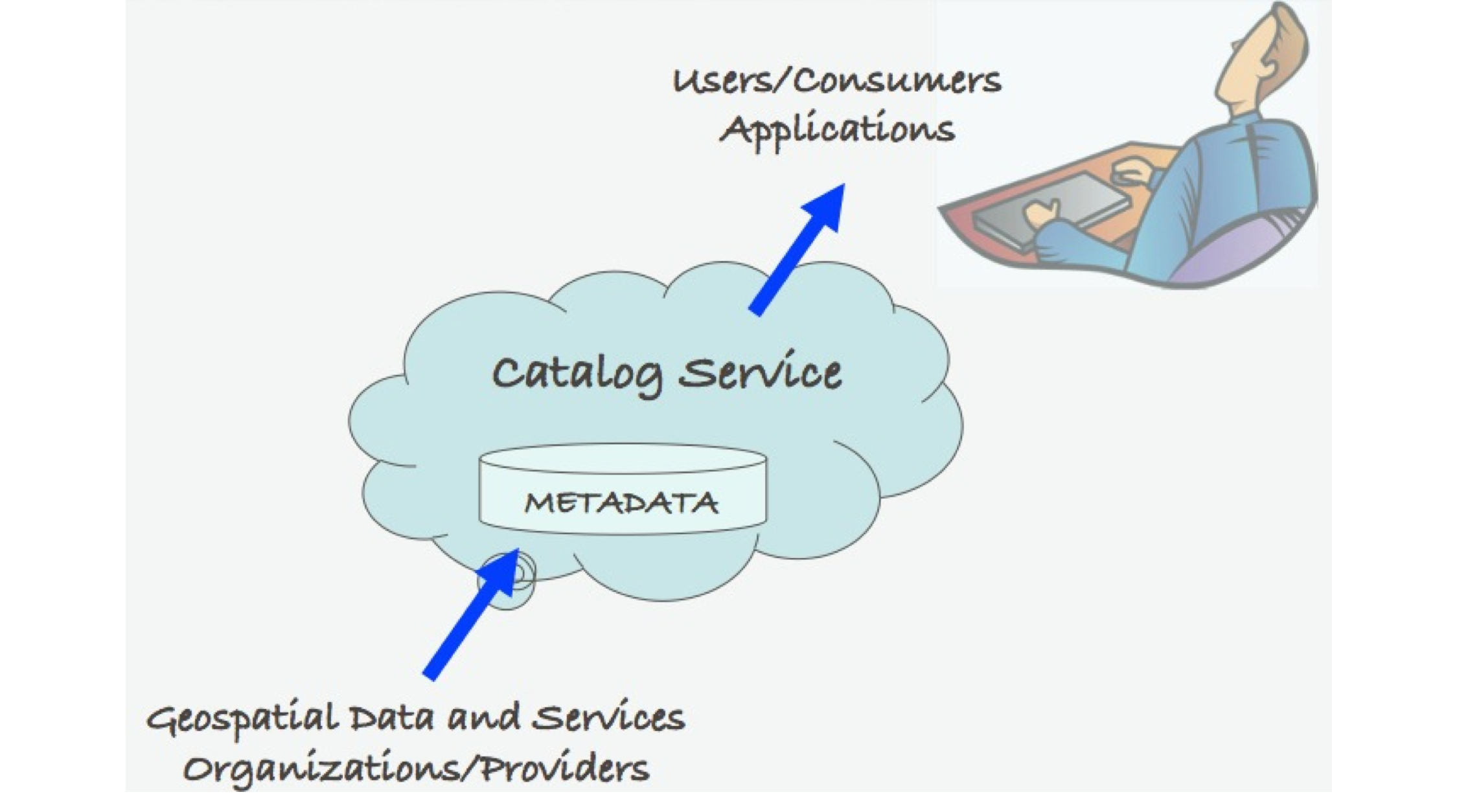
Catalog
Organized, detailed, descriptive list of items
arranged systematically (so they can be found)
Catalog

Catalog Service
Registry
System for maintaining a register or authoritative list of names / values / types / relationships (so they can be referenced)
Repository or Archive
Place for storage of resources (so they can be retrieved)
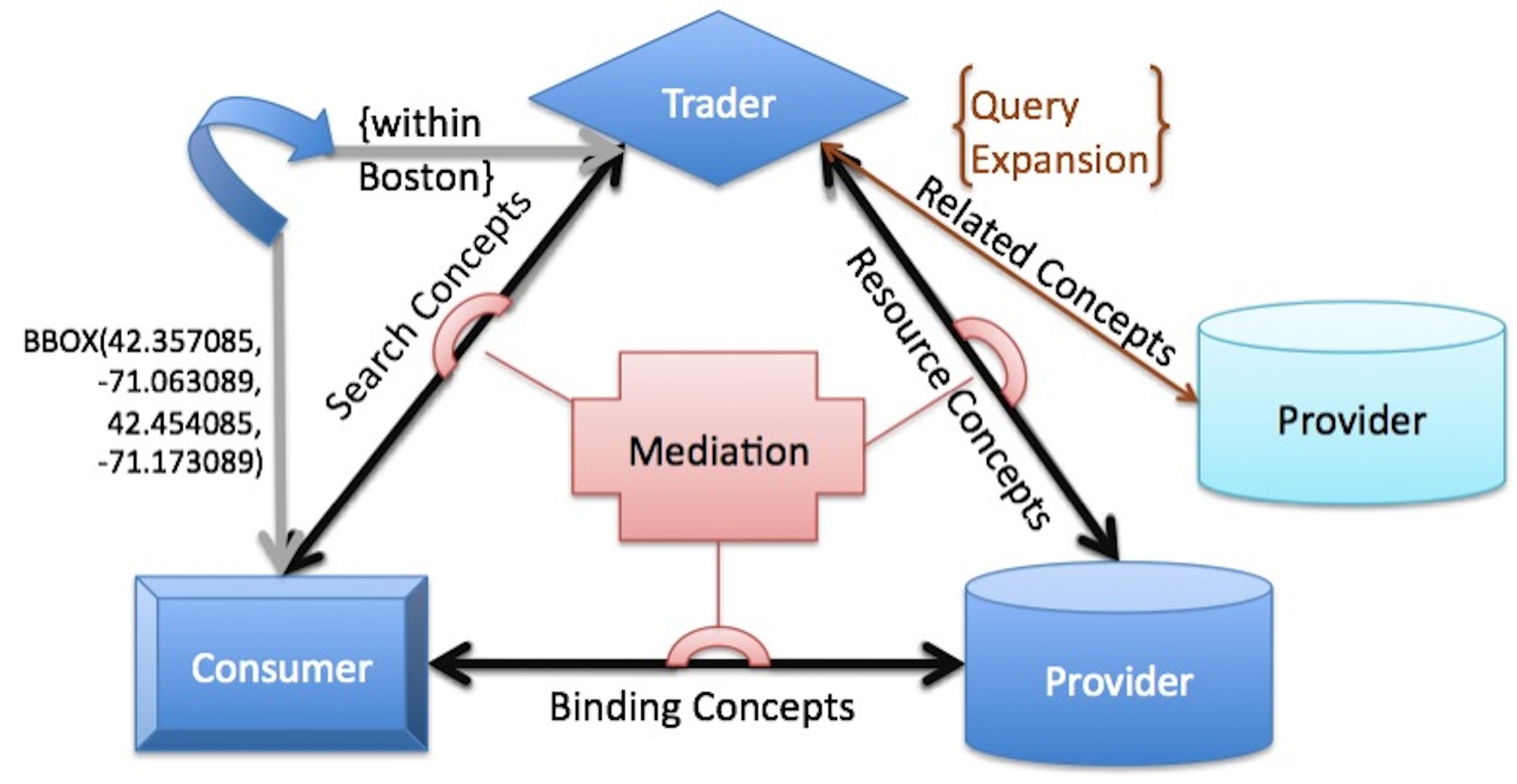
Trader
Intermediary in a service oriented architecture
Connects providers with consumers)
Discovery using SOA
Example: Geospatial Platform
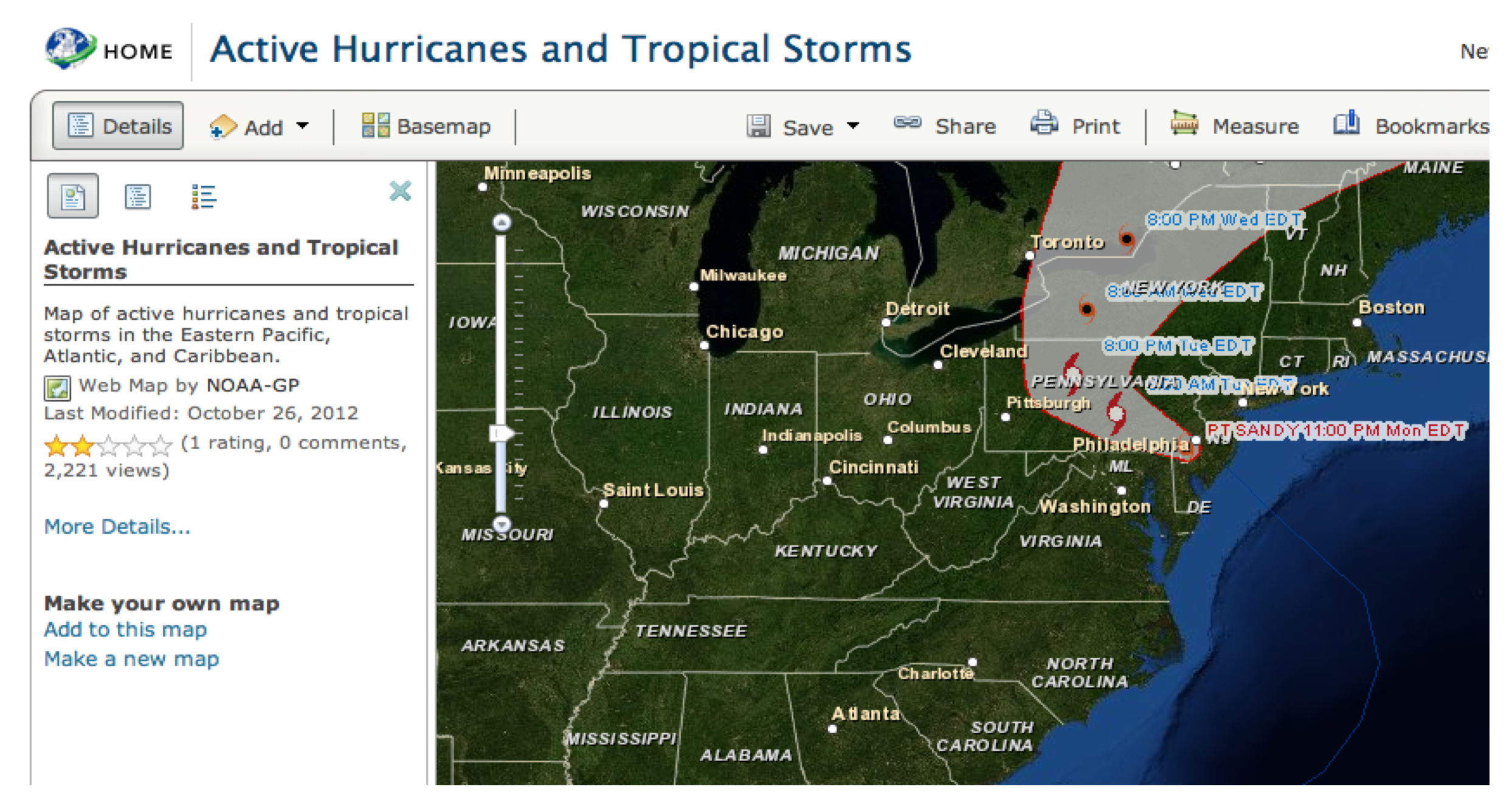
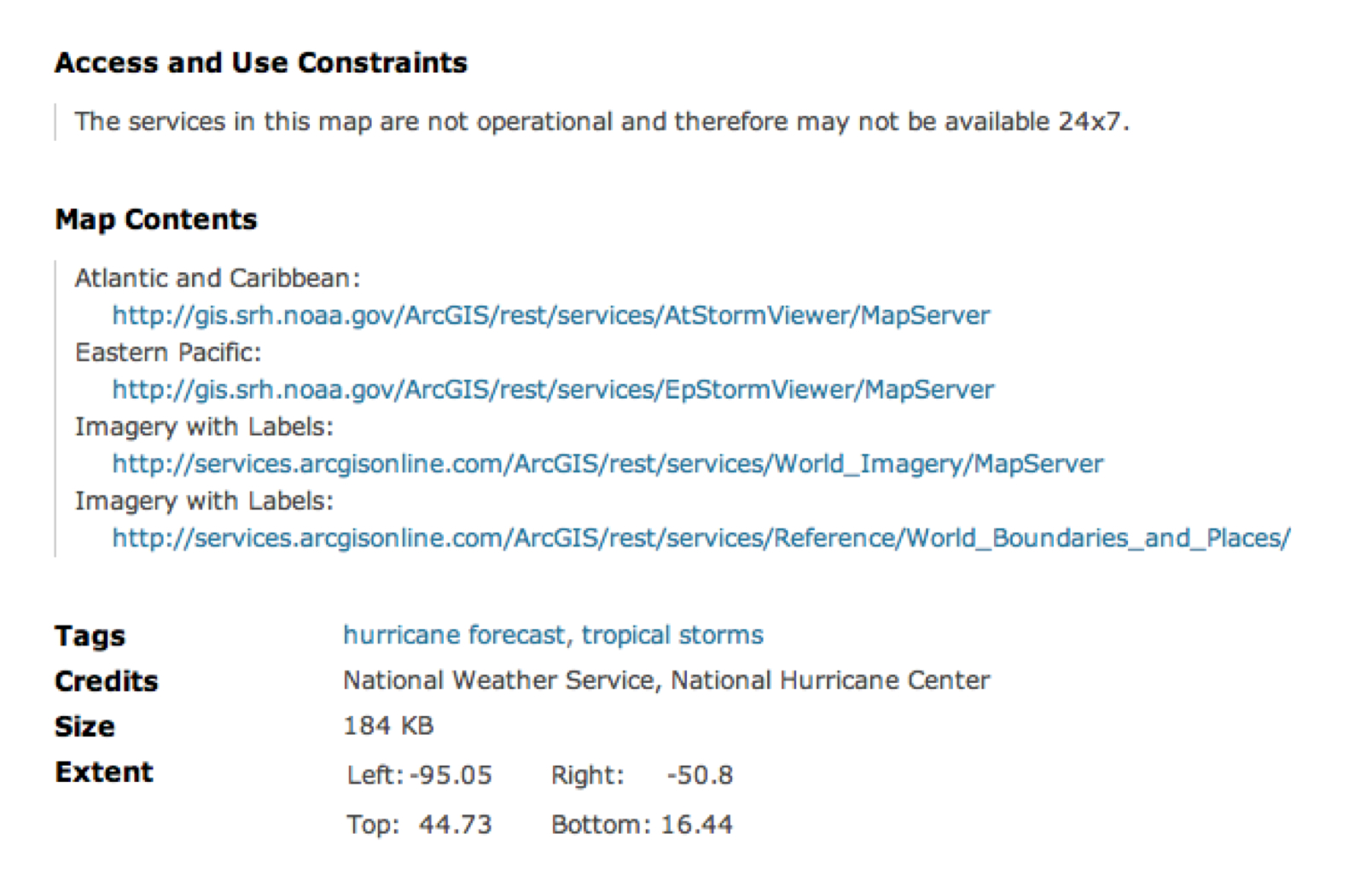
Metadata for Hurricane Map
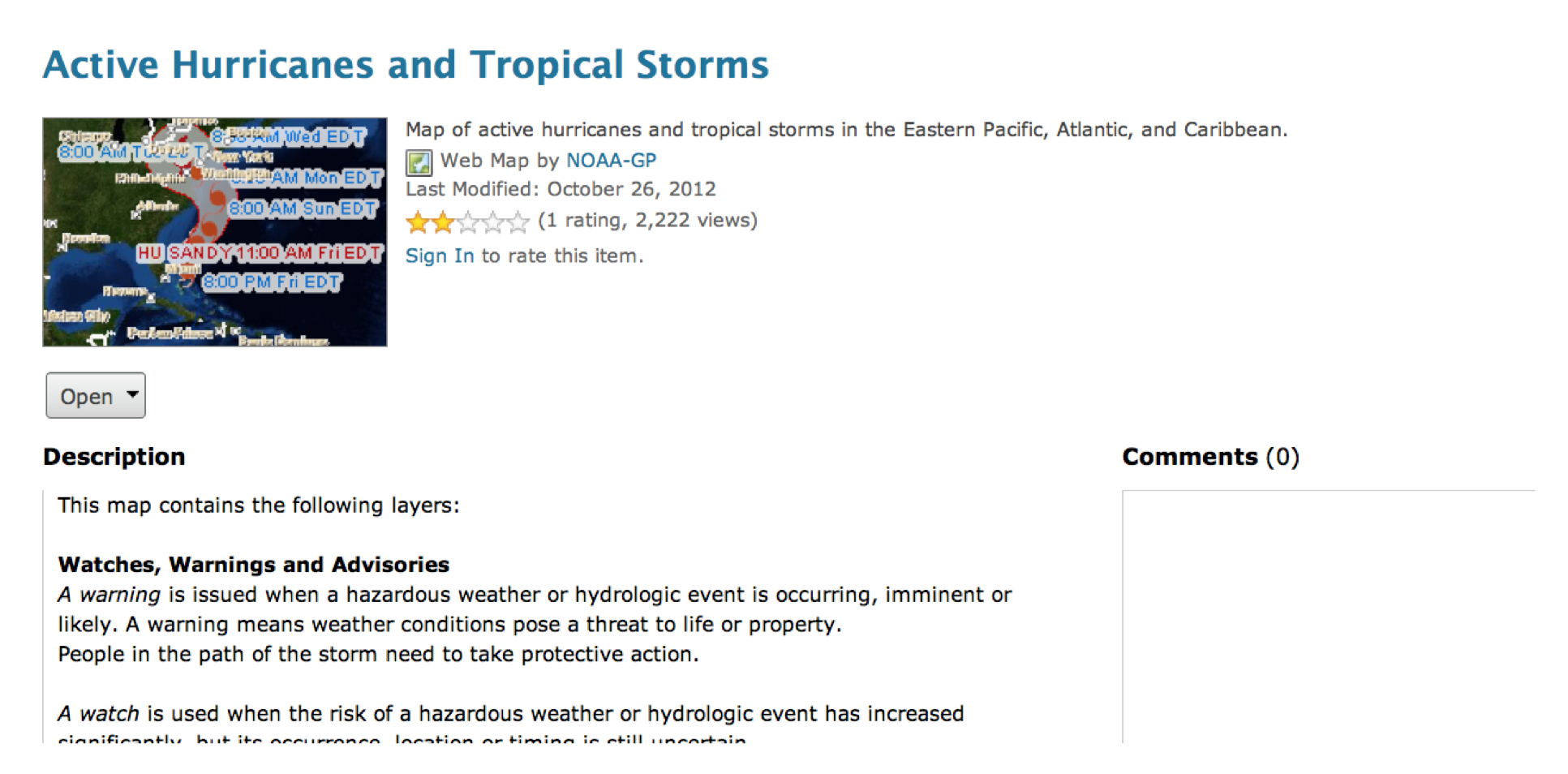
Metadata for Hurricane Map