Features
Vector feature data are geographic entities including conceptual ones such as districts, real world objects such as roads and rivers, and observations. (An observation is an act that results in the estimation of the value of a feature property, and involves application of a specified procedure, such as a sensor, instrument, algorithm or process chain. A temperature at a given geographic location provided by a sensor is an example of an observation.)
For vector feature data, there is one additional required table: gpkg_geometry_columns.
Features are stored in the user-defined data tables identified by the table_name values in gpkg_contents (one table per row).
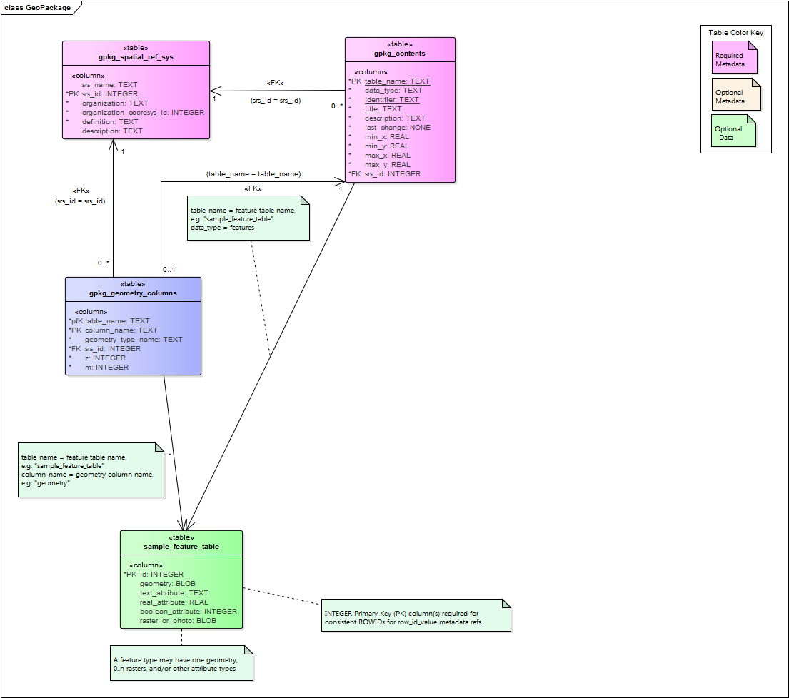
Figure 1: UML Diagram of Features tables
gpkg_geometry_columns
The gpkg_geometry_columns table describes the geometry for a particular Features table.
Each feature table must have a corresponding row in this table. The required columns in this table are:
table_nameandcolumn_namewhere the geometries are storedgeometry_type_namehttp://www.geopackage.org/spec130/#geometry_types_coresrs_idthe spatial reference system (see previous page)zandmare flags to indicate 3D/4D applications (Z values are for height/elevation/depth and M values are reserved for other types of domain-specific measurements)
User-defined Data Tables
Features are stored in user-defined data tables. Each features table has exactly one geometry column, a BLOB. (The structure of this BLOB is described here.) The OGC Simple Features geometry types are the supported geometry types. Other than the geometry column and a primary key, the schema of a features table is up to the implementer. Properties (text, integer, or real) provide additional information about each feature. The GeoPackage standard has an example schema.
The Schema Extension can be used to describe columns in more detail than just their name.