Area Query Resources of OGC API - EDR
An area is a region specified with a geographic envelope that may have vertical dimension. An illustration, created using NASA WorldWind, is shown below.
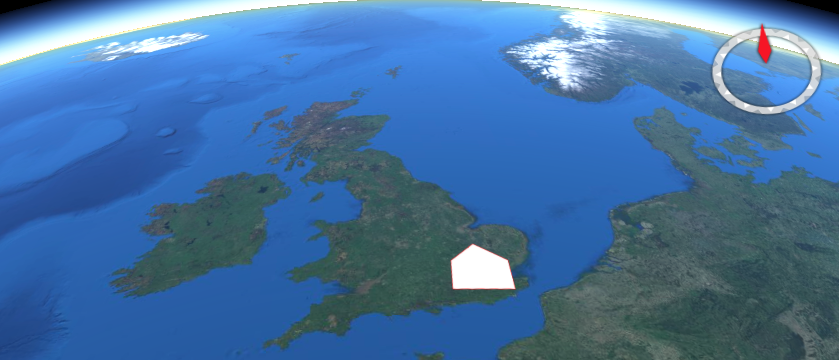
The area query resource returns data for the defined area. The resource offers a convenience mechanism for querying the API by area, using a Well Known Text (WKT) POLYGON geometry.
The path to the resource is shown below:
/collections/{collectionId}/area
The paths accepts the following parameters:
coords
z
parameter-name
datetime
crs
f
An example request is shown below.
http://example.org/edr/collections/gfs-pressure_at_height/area?coords=POLYGON((-0.898132%2051.179362,-0.909119%2051.815488,0.552063%2051.818884,0.560303%2051.191414,-0.898132%2051.179362))¶meter-name=Pressure_height_above_ground&datetime=2022-01-19T06:00Z/2022-01-19T12:00Z&z=80/80&crs=CRS84&f=CoverageJSON